
Features Earth Explorer 3D Map
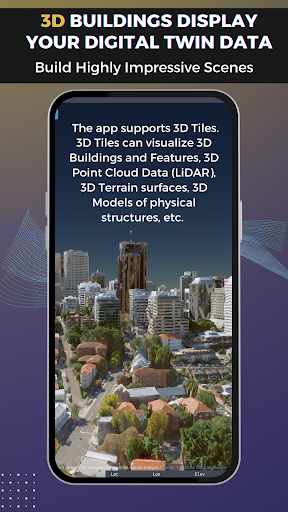
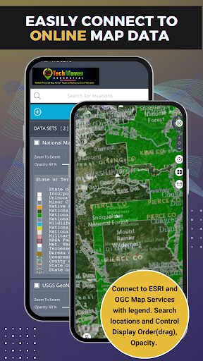
Earth Explorer is a 3D Globe with Augmented Reality (Control View with your device’s sensors GPS/GNSS, Accelerometer, Gyroscope, Compass, other)Users can load local vector data to the mapSupported formats are:GeoJSONKML/KMZGPXCZMLCSV - Comma Separated Value Text file - with Latitude and Longitude or with known column/field names like state, zipcode,country and other regional mapping fieldsJSON Catalog files - data layers defined in a JSON file.Users can load online mapping services:ESRI Dynamic REST Mapping Services (MapServer, FeatureServer,ImageServer)OGC Mapping Services (WMS, WFS, WCS, WMTS)Raster Tile Servers - XYZ URLVector Tile Server - XYZ URLIf users have Vector Data in other formats, they can upload to our server and have it converted and sent back to app/map as GeoJSON.
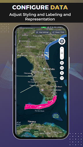
App Features:Measure Linear and Area Search and GeocodeRaster Tile Basemap Picker - uses BING Maps, Open Street Map, CartoDB Basemaps, Stamen Basemaps, ESRI BasemapsSplit/Map Swipe to compare layersSwitch map between 3D Terrain, 2D or 3D SmoothGeolocation show your location on the mapTilt MapRotate MapTable of Contents and Map Legend and ability to re-order data layers by draggingDisplays Coordinates in Lat Long or UTMDrop MarkersCopy Lat LongAbility to download tables from data loadedZoom to Extent of DataCharting Timeslider on Spatialtemporal datasetsExport/Print PNG/PDF of MapShare Link and Embed codeView Metadata (data about data)Re-Order Table of Contents ItemsSearch CKAN/CSW/SOCRATA OpenData Sites if Catalog file imported
Social Features
Connect and share with friends and the community.
Gaming Features
Enjoy immersive gaming experience with various game modes.
Weather Features
Get accurate weather forecasts and real-time updates.
See the Earth Explorer 3D Map in Action
Get the App Today
Available for Android 8.0 and above